 vesseltracker.com
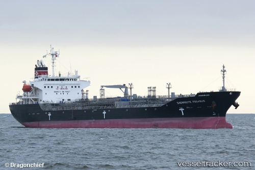
Chemroute Pegasus
Current StatusWhere is the vessel?
Chemroute Pegasus is currently in 13 nm N of Rozi, based on AIS data received less than 1h ago.
Latest AIS update:
Current position: 22.78684° N, 70.03749° E (13 nm N of Rozi)
Average speed (last 7 days): Loading…
Average speed (last 30 days): Loading…
Vessel profile: Chemroute Pegasus is a Chemical Oil Products Tanker with dimensions 27m x 159m.
This page combines live AIS, route history, probable destination signals, nearby traffic, and port activity for practical vessel monitoring.
The current position of vessel Chemroute Pegasus is 22.78684 lat / 70.03749 lng. Updated: 2026-05-02 21:55:03 UTCNearest reference points:
- 12 nm N of Rozi
- 15 nm N of Rozi
- Near Rozi
Details:
Live Vessel Chemroute Pegasus Analytics (details, animations, etc.)
Recent AIS points (UTC):
2026-05-02 18:19:03 UTC · 22.78688, 70.03753 · SOG 0.1 kn · COG 237°2026-05-02 18:58:03 UTC · 22.78660, 70.03771 · SOG 0.2 kn · COG 240°
2026-05-02 19:37:03 UTC · 22.78685, 70.03752 · SOG 0.2 kn · COG 240°
2026-05-02 21:55:03 UTC · 22.78684, 70.03749 · SOG 0.1 kn · COG 229°