 vesseltracker.com
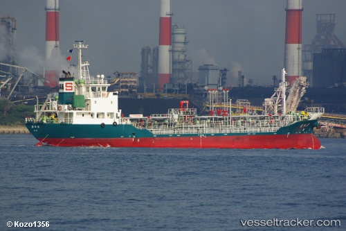
 Houwamaru
Current Status
Where is the vessel?
Houwamaru is currently in Near Atumi, based on AIS data received less than 1h ago.
Latest AIS update:
Current position: 34.54888° N, 137.21078° E (Near Atumi)
Average speed (last 7 days): Loading…
Average speed (last 30 days): Loading…
Vessel profile: Houwamaru is a Chemical Oil Products Tanker with dimensions 62m x 10m.
This page combines live AIS, route history, probable destination signals, nearby traffic, and port activity for practical vessel monitoring.
The current position of vessel Houwamaru is 34.54888 lat / 137.21078 lng. Updated: 2026-05-15 07:49:36 UTCNearest reference points:
- 17 nm S of TOYOHASHI
- Near TOYOHASHI
- 12 nm E of TOBA
Currently sailing under the flag of Japan ![]()
Details:
Live Vessel Houwamaru Analytics (details, animations, etc.)
Recent AIS points (UTC):
2026-05-15 05:00:00 UTC · 34.69996, 136.81625 · SOG 8.2 kn · COG 154°2026-05-15 05:46:32 UTC · 34.62620, 136.90388 · SOG 8 kn · COG 130°
2026-05-15 07:06:55 UTC · 34.54398, 137.08640 · SOG 8.7 kn · COG 89°
2026-05-15 07:49:36 UTC · 34.54888, 137.21078 · SOG 9 kn · COG 90°