 vesseltracker.com
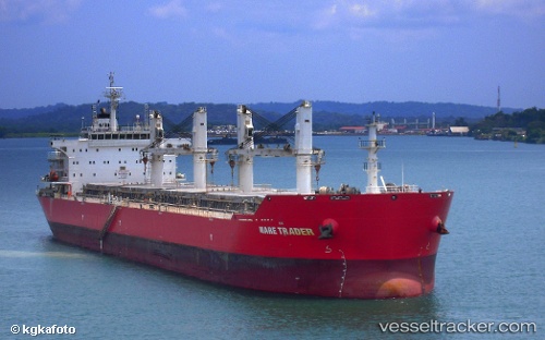
 YING LI
Current Status
Where is the vessel?
YING LI is currently in 15 nm E of Sulina (Port et Zone Franche), based on AIS data received less than 1h ago.
Latest AIS update:
Current position: 45.07006° N, 29.99899° E (15 nm E of Sulina (Port et Zone Franche))
Average speed (last 7 days): Loading…
Average speed (last 30 days): Loading…
Vessel profile: YING LI is a Bulk Carrier with dimensions m x m.
This page combines live AIS, route history, probable destination signals, nearby traffic, and port activity for practical vessel monitoring.
The current position of vessel YING LI is 45.07006 lat / 29.99899 lng. Updated: 2026-04-29 13:26:04 UTCNearest reference points:
- 13 nm E of Sulina (Port et Zone Franche)
- 12 nm SE of Sulina (Port et Zone Franche)
- Near Ust-Dunaisk/Vylkove
Currently sailing under the flag of Panama ![]()
Details:
Live Vessel YING LI Analytics (details, animations, etc.)
Recent AIS points (UTC):
2026-04-29 10:26:02 UTC · 45.07174, 30.00289 · SOG 0 kn · COG 272°2026-04-29 10:41:02 UTC · 45.07161, 30.00285 · SOG 0 kn · COG 278°
2026-04-29 11:41:06 UTC · 45.07171, 30.00277 · SOG 0 kn · COG 276°
2026-04-29 13:26:04 UTC · 45.07006, 29.99899 · SOG 0.1 kn · COG 23°