 vesseltracker.com
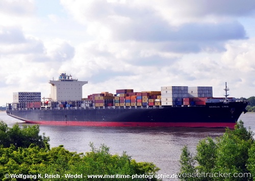
Seroja Lima
Current StatusWhere is the vessel?
Seroja Lima is currently in 10 nm S of ZHOUSHAN, based on AIS data received about 1h ago.
Latest AIS update:
Current position: 29.80179° N, 122.15893° E (10 nm S of ZHOUSHAN)
Average speed (last 7 days): Loading…
Average speed (last 30 days): Loading…
Vessel profile: Seroja Lima is a Container Ship with dimensions 46m x 316m.
This page combines live AIS, route history, probable destination signals, nearby traffic, and port activity for practical vessel monitoring.
The current position of vessel Seroja Lima is 29.80179 lat / 122.15893 lng. Updated: 2026-05-15 19:54:13 UTCNearest reference points:
- 10 nm SE of Daxie Pt
- Near ZHOUSHAN
- 11 nm S of ZHOUSHAN
Details:
Live Vessel Seroja Lima Analytics (details, animations, etc.)
Recent AIS points (UTC):
2026-05-15 16:54:14 UTC · 29.80181, 122.15891 · SOG 0 kn · COG 141°2026-05-15 18:00:13 UTC · 29.80187, 122.15900 · SOG 0 kn · COG 141°
2026-05-15 19:39:09 UTC · 29.80181, 122.15892 · SOG 0 kn · COG 141°
2026-05-15 19:54:13 UTC · 29.80179, 122.15893 · SOG 0 kn · COG 141°