 vesseltracker.com
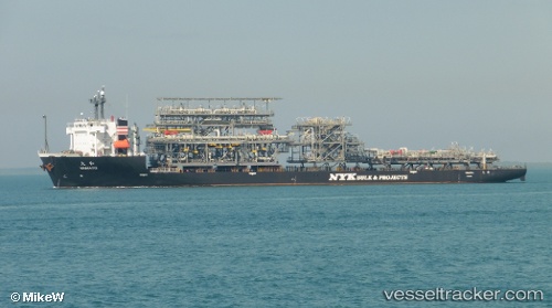
 Yamato
Current Status
Where is the vessel?
Yamato is currently in 138 nm NW of Laoag, Luzon, based on AIS data received less than 1h ago.
Latest AIS update:
Current position: 19.23833° N, 118.43167° E (138 nm NW of Laoag, Luzon)
Average speed (last 7 days): Loading…
Average speed (last 30 days): Loading…
Vessel profile: Yamato is a Heavy Load Carrier with dimensions 162m x 38m.
This page combines live AIS, route history, probable destination signals, nearby traffic, and port activity for practical vessel monitoring.
The current position of vessel Yamato is 19.23833 lat / 118.43167 lng. Updated: 2026-05-15 07:59:26 UTCNearest reference points:
- 148 nm SE of Xijiang
- 132 nm SW of Kaohsiung
- 138 nm NW of Bolinao
Currently sailing under the flag of Panama ![]()
Yamato built in 2010 year
Deadweight:
19812 tDetails:
Live Vessel Yamato Analytics (details, animations, etc.)
Recent AIS points (UTC):
2026-05-15 04:29:29 UTC · 18.82833, 118.01500 · SOG 9 kn · COG -1°2026-05-15 06:02:28 UTC · 19.00833, 118.20500 · SOG 9 kn · COG -1°
2026-05-15 07:59:26 UTC · 19.23833, 118.43167 · SOG 10 kn · COG -1°
2026-05-15 07:59:26 UTC · 19.23833, 118.43167 · SOG 10 kn · COG -1°