 vesseltracker.com
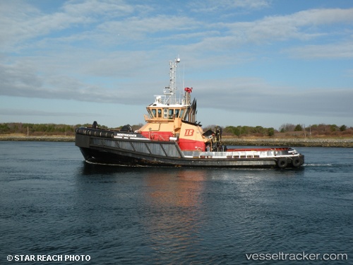
 INDEPENDENCE
Current Status
Where is the vessel?
INDEPENDENCE is currently in Near Westport Point, based on AIS data received less than 1h ago.
Latest AIS update:
Current position: 41.47027° N, 70.95260° W (Near Westport Point)
Average speed (last 7 days): Loading…
Average speed (last 30 days): Loading…
Vessel profile: INDEPENDENCE is a Tug with dimensions m x m.
This page combines live AIS, route history, probable destination signals, nearby traffic, and port activity for practical vessel monitoring.
The current position of vessel INDEPENDENCE is 41.47027 lat / -70.95260 lng. Updated: 2026-05-14 19:46:13 UTCNearest reference points:
- Near FAIRHAVEN
- Near NEW BEDFORD
- Near VINEYARD HAVEN
Currently sailing under the flag of United States ![]()
Details:
Live Vessel INDEPENDENCE Analytics (details, animations, etc.)
Recent AIS points (UTC):
2026-05-14 16:51:23 UTC · 41.73824, -70.62358 · SOG 0 kn · COG 226°2026-05-14 18:04:40 UTC · 41.65776, -70.68741 · SOG 10 kn · COG 191°
2026-05-14 19:36:24 UTC · 41.48157, -70.91925 · SOG 10.1 kn · COG 240°
2026-05-14 19:46:13 UTC · 41.47027, -70.95260 · SOG 10.4 kn · COG 242°