 vesseltracker.com
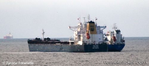
 STAR PEACE
Current Status
Where is the vessel?
STAR PEACE is currently in Near Fateh Terminal, based on AIS data received about 2d ago.
Latest AIS update:
Current position: 25.64318° N, 54.55808° E (Near Fateh Terminal)
Average speed (last 7 days): Loading…
Average speed (last 30 days): Loading…
Vessel profile: STAR PEACE is a Bulk Carrier with dimensions 229m x 32m.
This page combines live AIS, route history, probable destination signals, nearby traffic, and port activity for practical vessel monitoring.
The current position of vessel STAR PEACE is 25.64318 lat / 54.55808 lng. Updated: 2026-05-11 09:18:44 UTCNearest reference points:
- 11 nm SW of Fateh Terminal
- 17 nm NW of Free Port
- 16 nm NW of Jebel Ali
Currently sailing under the flag of Bahamas ![]()
STAR PEACE built in 2011 year
Deadweight:
79025 tDetails:
Live Vessel STAR PEACE Analytics (details, animations, etc.)
Recent AIS points (UTC):
2026-05-11 09:18:44 UTC · 25.64318, 54.55808 · SOG 0.1 kn · COG 255°2026-05-11 09:18:44 UTC · 25.64318, 54.55808 · SOG 0.1 kn · COG 255°
2026-05-11 09:18:44 UTC · 25.64318, 54.55808 · SOG 0.1 kn · COG 255°
2026-05-11 09:18:44 UTC · 25.64318, 54.55808 · SOG 0.1 kn · COG 255°