 vesseltracker.com
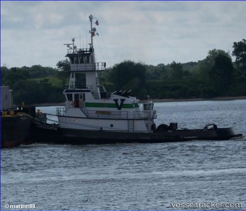
Charles Burton
Current StatusWhere is the vessel?
Charles Burton is currently in Near New Hamburg, based on AIS data received about 112d ago.
Latest AIS update:
Current position: 41.61667° N, 73.94833° W (Near New Hamburg)
Average speed (last 7 days): Loading…
Average speed (last 30 days): Loading…
Vessel profile: Charles Burton is a Pusher Tug with dimensions 10m x 32m.
This page combines live AIS, route history, probable destination signals, nearby traffic, and port activity for practical vessel monitoring.
The current position of vessel Charles Burton is 41.61667 lat / -73.94833 lng. Updated: 2026-01-21 09:13:57 UTCNearest reference points:
- Near Larchmont
- Near Purchase
- Near Hoboken
Details:
Live Vessel Charles Burton Analytics (details, animations, etc.)
Recent AIS points (UTC):
2026-01-21 09:13:57 UTC · 41.61667, -73.94833 · SOG 0 kn · COG -1°