 vesseltracker.com
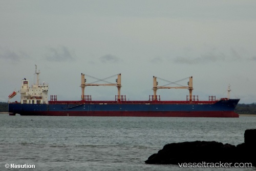
 LADY KATERINA
Current Status
Where is the vessel?
LADY KATERINA is currently in 355 nm W of Tinaquillo, based on AIS data received less than 1h ago.
Latest AIS update:
Current position: 11.40759° N, 62.47859° E (355 nm W of Tinaquillo)
Average speed (last 7 days): Loading…
Average speed (last 30 days): Loading…
Vessel profile: LADY KATERINA is a Bulk Carrier with dimensions m x m.
This page combines live AIS, route history, probable destination signals, nearby traffic, and port activity for practical vessel monitoring.
The current position of vessel LADY KATERINA is 11.40759 lat / 62.47859 lng. Updated: 2026-05-15 22:04:00 UTCNearest reference points:
- Open sea, approx. 400 nm off the nearest listed port
- Open sea, approx. 401 nm off the nearest listed port
- Open sea, approx. 402 nm off the nearest listed port
Currently sailing under the flag of Barbados ![]()
Details:
Live Vessel LADY KATERINA Analytics (details, animations, etc.)
Recent AIS points (UTC):
2026-05-15 19:29:00 UTC · 11.54532, 61.91785 · SOG 12.7 kn · COG 103°2026-05-15 20:23:31 UTC · 11.49586, 62.11183 · SOG 13 kn · COG 104°
2026-05-15 21:42:51 UTC · 11.42611, 62.40059 · SOG 13.5 kn · COG 105°
2026-05-15 22:04:00 UTC · 11.40759, 62.47859 · SOG 13.2 kn · COG 106°