 vesseltracker.com
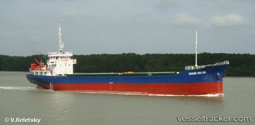
Hoang Hai 68
Current StatusWhere is the vessel?
Hoang Hai 68 is currently in 157 nm N of Pulau Lang Lang, based on AIS data received about 25d ago.
Latest AIS update:
Current position: 10.01925° N, 113.85085° E (157 nm N of Pulau Lang Lang)
Average speed (last 7 days): Loading…
Average speed (last 30 days): Loading…
Vessel profile: Hoang Hai 68 is a Bulk Carrier with dimensions 12m x 75m.
This page combines live AIS, route history, probable destination signals, nearby traffic, and port activity for practical vessel monitoring.
The current position of vessel Hoang Hai 68 is 10.01925 lat / 113.85085 lng. Updated: 2026-04-20 08:32:53 UTCNearest reference points:
- 175 nm N of Pulau Lang Lang
- 159 nm N of Pulau Lang Lang
- 141 nm N of Pulau Lang Lang
Details:
Live Vessel Hoang Hai 68 Analytics (details, animations, etc.)
Recent AIS points (UTC):
2026-04-20 08:32:53 UTC · 10.01925, 113.85085 · SOG 0 kn · COG -1°