 vesseltracker.com
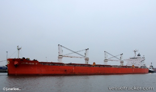
 Anjelique D
Current Status
Where is the vessel?
Anjelique D is currently in 23 nm E of The Pearl-Qatar, based on AIS data received about 1d ago.
Latest AIS update:
Current position: 25.41304° N, 51.97352° E (23 nm E of The Pearl-Qatar)
Average speed (last 7 days): Loading…
Average speed (last 30 days): Loading…
Vessel profile: Anjelique D is a Bulk Carrier with dimensions 24m x 12m.
This page combines live AIS, route history, probable destination signals, nearby traffic, and port activity for practical vessel monitoring.
The current position of vessel Anjelique D is 25.41304 lat / 51.97352 lng. Updated: 2026-05-13 17:03:38 UTCNearest reference points:
- Near RAS LAFFAN
- 21 nm NE of Halul Island
- Near Das Island
Currently sailing under the flag of Cayman Is ![]()
Anjelique D built in 2012 year
Deadweight:
58689 tDetails:
Live Vessel Anjelique D Analytics (details, animations, etc.)
Recent AIS points (UTC):
2026-05-13 17:03:38 UTC · 25.41304, 51.97352 · SOG 0 kn · COG 330°2026-05-13 17:03:38 UTC · 25.41304, 51.97352 · SOG 0 kn · COG 330°
2026-05-13 17:03:38 UTC · 25.41304, 51.97352 · SOG 0 kn · COG 330°
2026-05-13 17:03:38 UTC · 25.41304, 51.97352 · SOG 0 kn · COG 330°