 vesseltracker.com
 SKOUL LOUET
Current Status
Where is the vessel?
SKOUL LOUET is currently in Near Tchatamba, based on AIS data received about 1h ago.
Latest AIS update:
Current position: 2.07479° S, 9.16025° E (Near Tchatamba)
Average speed (last 7 days): Loading…
Average speed (last 30 days): Loading…
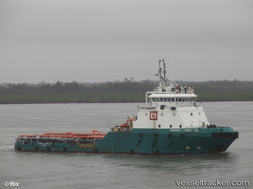
Vessel profile: SKOUL LOUET is a Offshore Tug/Supply Ship with dimensions 15m x 60m.
This page combines live AIS, route history, probable destination signals, nearby traffic, and port activity for practical vessel monitoring.
The current position of vessel SKOUL LOUET is -2.07479 lat / 9.16025 lng. Updated: 2026-04-25 14:14:05 UTCNearest reference points:
- Near Port Gentil
- Near Cape Lopez
Currently sailing under the flag of St Vincent and Grenadines ![]()
SKOUL LOUET built in 2011 year
Deadweight:
1435 tDetails:
Live Vessel SKOUL LOUET Analytics (details, animations, etc.)
Recent AIS points (UTC):
2026-04-25 10:49:51 UTC · -2.08735, 8.95541 · SOG 4.1 kn · COG 92°2026-04-25 12:04:40 UTC · -2.08285, 9.06992 · SOG 5.6 kn · COG 78°
2026-04-25 13:16:45 UTC · -2.07502, 9.15964 · SOG 0.7 kn · COG 271°
2026-04-25 14:14:05 UTC · -2.07479, 9.16025 · SOG 2.5 kn · COG 310°