 vesseltracker.com
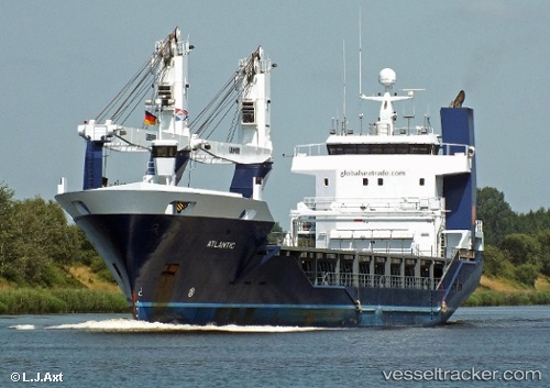
 Atlantic
Current Status
Where is the vessel?
Atlantic is currently in 34 nm N of Estombar, based on AIS data received less than 1h ago.
Latest AIS update:
Current position: 37.70372° N, 8.64695° E (34 nm N of Estombar)
Average speed (last 7 days): Loading…
Average speed (last 30 days): Loading…
Vessel profile: Atlantic is a General Cargo Ship with dimensions 105m x 16m.
This page combines live AIS, route history, probable destination signals, nearby traffic, and port activity for practical vessel monitoring.
The current position of vessel Atlantic is 37.70372 lat / 8.64695 lng. Updated: 2026-05-15 00:59:57 UTCNearest reference points:
- 35 nm S of Setubal
- 33 nm SE of Setubal
- Near Annaba
Currently sailing under the flag of Netherlands ![]()
Atlantic built in 2011 year
Deadweight:
3750 tDetails:
Live Vessel Atlantic Analytics (details, animations, etc.)
Recent AIS points (UTC):
2026-05-14 21:58:55 UTC · 37.68463, 7.71725 · SOG 15 kn · COG 79°2026-05-14 22:36:08 UTC · 37.71837, 7.90798 · SOG 15.1 kn · COG 79°
2026-05-14 23:43:53 UTC · 37.71346, 8.26043 · SOG 14.7 kn · COG 90°
2026-05-15 00:59:57 UTC · 37.70372, 8.64695 · SOG 14.7 kn · COG 82°