 vesseltracker.com
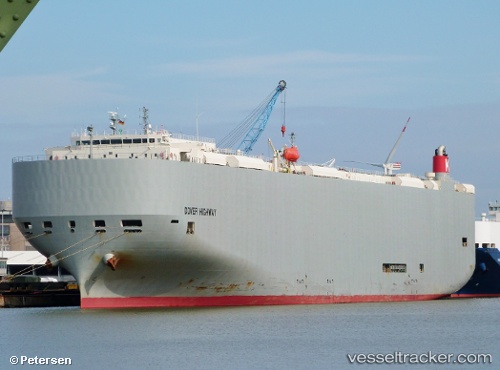
 Dover Highway
Current Status
Where is the vessel?
Dover Highway is currently in Near Rio De Janeiro, based on AIS data received less than 1h ago.
Latest AIS update:
Current position: 22.88494° S, 43.21382° W (Near Rio De Janeiro)
Average speed (last 7 days): Loading…
Average speed (last 30 days): Loading…
Vessel profile: Dover Highway is a Vehicles Carrier with dimensions 199m x 32m.
This page combines live AIS, route history, probable destination signals, nearby traffic, and port activity for practical vessel monitoring.
The current position of vessel Dover Highway is -22.88494 lat / -43.21382 lng. Updated: 2026-05-14 16:28:51 UTCNearest reference points:
- Near Rio De Janeiro
- Near NITEROI
- Near Santos Dumont Apt/Rio de Janeiro
Currently sailing under the flag of Japan ![]()
Dover Highway built in 2011 year
Deadweight:
18720 tDetails:
Live Vessel Dover Highway Analytics (details, animations, etc.)
Recent AIS points (UTC):
2026-05-14 13:55:54 UTC · -22.88492, -43.21385 · SOG 0 kn · COG -1°2026-05-14 13:58:32 UTC · -22.88492, -43.21385 · SOG 0 kn · COG -1°
2026-05-14 16:28:30 UTC · -22.88495, -43.21382 · SOG 0 kn · COG 206°
2026-05-14 16:28:51 UTC · -22.88494, -43.21382 · SOG 0 kn · COG 206°