 vesseltracker.com
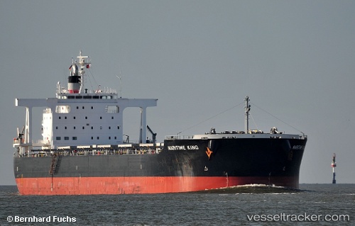
 Maritime King
Current Status
Where is the vessel?
Maritime King is currently in 49 nm SE of Pulau Lang Lang, based on AIS data received about 1d ago.
Latest AIS update:
Current position: 6.82161° N, 114.41558° E (49 nm SE of Pulau Lang Lang)
Average speed (last 7 days): Loading…
Average speed (last 30 days): Loading…
Vessel profile: Maritime King is a Bulk Carrier with dimensions 235m x 38m.
This page combines live AIS, route history, probable destination signals, nearby traffic, and port activity for practical vessel monitoring.
The current position of vessel Maritime King is 6.82161 lat / 114.41558 lng. Updated: 2026-05-13 03:43:20 UTCNearest reference points:
- 53 nm S of Pulau Lang Lang
- 44 nm SW of Tembungo
- Near Kikeh
Currently sailing under the flag of Panama ![]()
Maritime King built in 2011 year
Deadweight:
95675 tDetails:
Live Vessel Maritime King Analytics (details, animations, etc.)
Recent AIS points (UTC):
2026-05-12 14:20:56 UTC · 7.73994, 116.99280 · SOG 13 kn · COG 253°2026-05-12 14:20:56 UTC · 7.73994, 116.99280 · SOG 13 kn · COG 253°
2026-05-13 03:43:20 UTC · 6.82161, 114.41558 · SOG 11 kn · COG 249°
2026-05-13 03:43:20 UTC · 6.82161, 114.41558 · SOG 11 kn · COG 249°