 vesseltracker.com
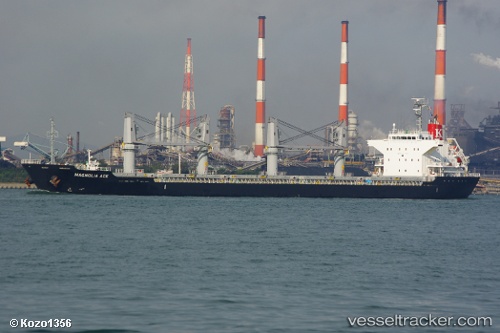
 Magnolia
Current Status
Where is the vessel?
Magnolia is currently in 34 nm S of Kidd's Beach, based on AIS data received less than 1h ago.
Latest AIS update:
Current position: 33.66074° S, 27.92614° E (34 nm S of Kidd's Beach)
Average speed (last 7 days): Loading…
Average speed (last 30 days): Loading…
Vessel profile: Magnolia is a Bulk Carrier with dimensions 169m x 27m.
This page combines live AIS, route history, probable destination signals, nearby traffic, and port activity for practical vessel monitoring.
The current position of vessel Magnolia is -33.66074 lat / 27.92614 lng. Updated: 2026-05-15 11:41:06 UTCNearest reference points:
- Near Deal Party
- 21 nm S of Mount Pleasant
- 23 nm E of Port Saint John's
Currently sailing under the flag of Marshall Is ![]()
Magnolia built in 2010 year
Deadweight:
28389 tDetails:
Live Vessel Magnolia Analytics (details, animations, etc.)
Recent AIS points (UTC):
2026-05-15 07:52:01 UTC · -33.89556, 27.21714 · SOG 10.3 kn · COG 66°2026-05-15 09:42:18 UTC · -33.77463, 27.55883 · SOG 9.7 kn · COG 68°
2026-05-15 10:29:17 UTC · -33.72774, 27.69825 · SOG 9.1 kn · COG 69°
2026-05-15 11:41:06 UTC · -33.66074, 27.92614 · SOG 10.7 kn · COG 67°