 vesseltracker.com
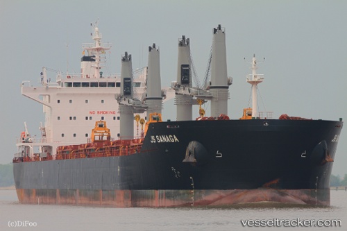
 Sage Sanaga
Current Status
Where is the vessel?
Sage Sanaga is currently in 38 nm S of Cabuya Cobano, based on AIS data received less than 1h ago.
Latest AIS update:
Current position: 8.97218° N, 85.11768° W (38 nm S of Cabuya Cobano)
Average speed (last 7 days): Loading…
Average speed (last 30 days): Loading…
Vessel profile: Sage Sanaga is a Bulk Carrier with dimensions 200m x 32m.
This page combines live AIS, route history, probable destination signals, nearby traffic, and port activity for practical vessel monitoring.
The current position of vessel Sage Sanaga is 8.97218 lat / -85.11768 lng. Updated: 2026-05-02 13:41:06 UTCNearest reference points:
- 67 nm SW of Sámara
- Near Golfo de Papagayo
- 27 nm W of Playa Conchal
Currently sailing under the flag of Liberia ![]()
Sage Sanaga built in 2013 year
Deadweight:
63500 tDetails:
Live Vessel Sage Sanaga Analytics (details, animations, etc.)
Recent AIS points (UTC):
2026-05-02 09:56:59 UTC · 9.40418, -85.74374 · SOG 12 kn · COG 126°2026-05-02 11:20:16 UTC · 9.24342, -85.51144 · SOG 12.1 kn · COG 126°
2026-05-02 13:25:37 UTC · 9.00086, -85.16098 · SOG 11.9 kn · COG 124°
2026-05-02 13:41:06 UTC · 8.97218, -85.11768 · SOG 12 kn · COG 124°