 vesseltracker.com
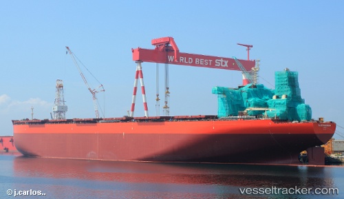
 SEA MARANHAO
Current Status
Where is the vessel?
SEA MARANHAO is currently in 17 nm S of Moorreesburg, based on AIS data received less than 1h ago.
Latest AIS update:
Current position: 34.78436° S, 18.66461° E (17 nm S of Moorreesburg)
Average speed (last 7 days): Loading…
Average speed (last 30 days): Loading…
Vessel profile: SEA MARANHAO is a Ore Carrier with dimensions 65m x 361m.
This page combines live AIS, route history, probable destination signals, nearby traffic, and port activity for practical vessel monitoring.
The current position of vessel SEA MARANHAO is -34.78436 lat / 18.66461 lng. Updated: 2026-05-14 22:33:55 UTCNearest reference points:
- 15 nm SE of Moorreesburg
- 18 nm SW of Cape Of Good Hope
- Near Mitchells Plain
Currently sailing under the flag of Marshall Islands ![]()
SEA MARANHAO built in 2013 year
Deadweight:
403844 tDetails:
Live Vessel SEA MARANHAO Analytics (details, animations, etc.)
Recent AIS points (UTC):
2026-05-14 19:37:49 UTC · -34.89751, 19.18785 · SOG 8.8 kn · COG 284°2026-05-14 20:03:56 UTC · -34.87988, 19.11250 · SOG 8.9 kn · COG 282°
2026-05-14 22:00:01 UTC · -34.80759, 18.77078 · SOG 9.4 kn · COG 279°
2026-05-14 22:33:55 UTC · -34.78436, 18.66461 · SOG 9.7 kn · COG 279°