 vesseltracker.com
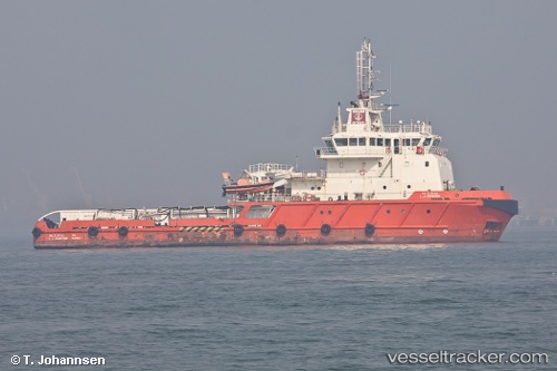
L J Johnson
Current StatusWhere is the vessel?
L J Johnson is currently in 89 nm W of Palghar, based on AIS data received less than 1h ago.
Latest AIS update:
Current position: 19.32333° N, 71.21833° E (89 nm W of Palghar)
Average speed (last 7 days): Loading…
Average speed (last 30 days): Loading…
Vessel profile: L J Johnson is a Offshore Tug Supply Ship with dimensions 14m x 59m.
This page combines live AIS, route history, probable destination signals, nearby traffic, and port activity for practical vessel monitoring.
The current position of vessel L J Johnson is 19.32333 lat / 71.21833 lng. Updated: 2026-05-15 00:59:56 UTCNearest reference points:
- 33 nm S of Mul Dwårka
- Near Jafarabad
- 17 nm SE of Port Pipavav
Details:
Live Vessel L J Johnson Analytics (details, animations, etc.)
Recent AIS points (UTC):
2026-05-14 21:32:45 UTC · 19.23718, 71.28740 · SOG 2 kn · COG 311°2026-05-14 22:56:54 UTC · 19.26333, 71.25333 · SOG 2 kn · COG -1°
2026-05-14 23:44:55 UTC · 19.28500, 71.23833 · SOG 1 kn · COG -1°
2026-05-15 00:59:56 UTC · 19.32333, 71.21833 · SOG 2 kn · COG -1°