 vesseltracker.com
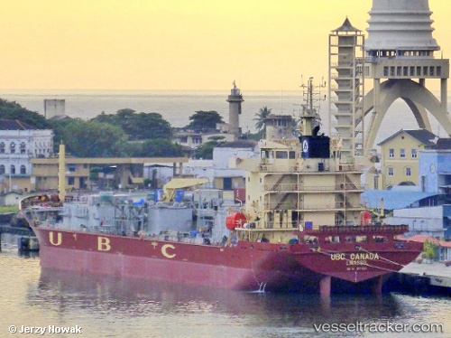
 HESTIA CEMENT
Current Status
Where is the vessel?
HESTIA CEMENT is currently in 41 nm NW of Atakka Dry Port, based on AIS data received less than 1h ago.
Latest AIS update:
Current position: 32.42169° N, 32.29134° E (41 nm NW of Atakka Dry Port)
Average speed (last 7 days): Loading…
Average speed (last 30 days): Loading…
Vessel profile: HESTIA CEMENT is a Cement Carrier with dimensions m x m.
This page combines live AIS, route history, probable destination signals, nearby traffic, and port activity for practical vessel monitoring.
The current position of vessel HESTIA CEMENT is 32.42169 lat / 32.29134 lng. Updated: 2026-05-15 19:24:16 UTCNearest reference points:
- 24 nm SW of Atakka Dry Port
- 21 nm N of Port Said
- 16 nm N of Port Said
Currently sailing under the flag of Marshall Islands ![]()
Details:
Live Vessel HESTIA CEMENT Analytics (details, animations, etc.)
Recent AIS points (UTC):
2026-05-15 16:55:06 UTC · 32.60687, 32.80792 · SOG 11.2 kn · COG 249°2026-05-15 18:07:35 UTC · 32.51922, 32.56084 · SOG 11.3 kn · COG 249°
2026-05-15 19:12:56 UTC · 32.43561, 32.33174 · SOG 11.8 kn · COG 251°
2026-05-15 19:24:16 UTC · 32.42169, 32.29134 · SOG 11.8 kn · COG 251°