 vesseltracker.com
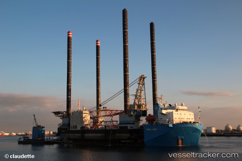
 Wish Way
Current Status
Where is the vessel?
Wish Way is currently in 62 nm E of San-Men Wen, based on AIS data received about 1h ago.
Latest AIS update:
Current position: 29.03160° N, 122.93669° E (62 nm E of San-Men Wen)
Average speed (last 7 days): Loading…
Average speed (last 30 days): Loading…
Vessel profile: Wish Way is a Heavy Load Carrier with dimensions 156m x 36m.
This page combines live AIS, route history, probable destination signals, nearby traffic, and port activity for practical vessel monitoring.
The current position of vessel Wish Way is 29.03160 lat / 122.93669 lng. Updated: 2026-04-30 16:35:10 UTCNearest reference points:
- 63 nm E of Shipu
- 65 nm SE of ZHOUSHAN
- 53 nm SE of Shipu
Currently sailing under the flag of Panama ![]()
Wish Way built in 2010 year
Deadweight:
21243 tDetails:
Live Vessel Wish Way Analytics (details, animations, etc.)
Recent AIS points (UTC):
2026-04-30 13:17:10 UTC · 29.03156, 122.93645 · SOG 0 kn · COG 33°2026-04-30 13:17:10 UTC · 29.03156, 122.93645 · SOG 0 kn · COG 33°
2026-04-30 13:17:10 UTC · 29.03156, 122.93645 · SOG 0 kn · COG 33°
2026-04-30 16:35:10 UTC · 29.03160, 122.93669 · SOG 0 kn · COG 29°