 vesseltracker.com
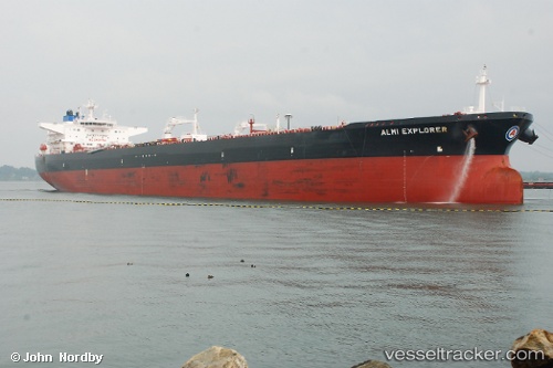
Almi Explorer
Current StatusWhere is the vessel?
Almi Explorer is currently in 161 nm W of Alozaina, based on AIS data received less than 1h ago.
Latest AIS update:
Current position: 35.78081° N, 17.96299° W (161 nm W of Alozaina)
Average speed (last 7 days): Loading…
Average speed (last 30 days): Loading…
Vessel profile: Almi Explorer is a Crude Oil Tanker with dimensions 50m x 274m.
This page combines live AIS, route history, probable destination signals, nearby traffic, and port activity for practical vessel monitoring.
The current position of vessel Almi Explorer is 35.78081 lat / -17.96299 lng. Updated: 2026-04-30 07:07:48 UTCNearest reference points:
- 150 nm NW of Ponta do Pargo
- 78 nm W of Nedroma
Details:
Live Vessel Almi Explorer Analytics (details, animations, etc.)
Recent AIS points (UTC):
2026-04-30 01:35:37 UTC · 35.76559, -19.56198 · SOG 14.3 kn · COG 91°2026-04-30 03:25:07 UTC · 35.76640, -19.02659 · SOG 14.4 kn · COG 87°
2026-04-30 04:09:27 UTC · 35.77192, -18.81089 · SOG 14.1 kn · COG 91°
2026-04-30 07:07:48 UTC · 35.78081, -17.96299 · SOG 14 kn · COG 89°