 vesseltracker.com
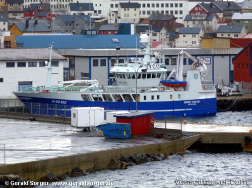
 Bernt Oskar
Current Status
Where is the vessel?
Bernt Oskar is currently in Near HONNINGSVAAG, based on AIS data received less than 1h ago.
Latest AIS update:
Current position: 70.99554° N, 25.95920° E (Near HONNINGSVAAG)
Average speed (last 7 days): Loading…
Average speed (last 30 days): Loading…
Vessel profile: Bernt Oskar is a Fishing Vessel with dimensions 37m x 36m.
This page combines live AIS, route history, probable destination signals, nearby traffic, and port activity for practical vessel monitoring.
The current position of vessel Bernt Oskar is 70.99554 lat / 25.95920 lng. Updated: 2026-04-27 04:13:48 UTCNearest reference points:
- Near HONNINGSVAAG
- Near SKARSVAG
- Near KJOLLEFJORD
Currently sailing under the flag of Norway ![]()
Bernt Oskar built in 2010 year
Deadweight:
1000 tDetails:
Live Vessel Bernt Oskar Analytics (details, animations, etc.)
Recent AIS points (UTC):
2026-04-27 01:15:08 UTC · 71.06844, 26.85666 · SOG 8 kn · COG 250°2026-04-27 01:22:47 UTC · 71.06261, 26.80731 · SOG 8.1 kn · COG 245°
2026-04-27 04:05:58 UTC · 70.99555, 25.95921 · SOG 0 kn · COG 228°
2026-04-27 04:13:48 UTC · 70.99554, 25.95920 · SOG 0 kn · COG 229°