 vesseltracker.com
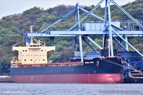
Rising Wind
Current StatusWhere is the vessel?
Rising Wind is currently in 21 nm NW of Iba, based on AIS data received about 1h ago.
Latest AIS update:
Current position: 15.53677° N, 119.69428° E (21 nm NW of Iba)
Average speed (last 7 days): Loading…
Average speed (last 30 days): Loading…
Vessel profile: Rising Wind is a Bulk Carrier with dimensions 32m x 229m.
This page combines live AIS, route history, probable destination signals, nearby traffic, and port activity for practical vessel monitoring.
The current position of vessel Rising Wind is 15.53677 lat / 119.69428 lng. Updated: 2026-04-28 00:07:20 UTCNearest reference points:
- 34 nm W of Iba
- 19 nm SW of MARIVELES
- Near Malabon
Details:
Live Vessel Rising Wind Analytics (details, animations, etc.)
Recent AIS points (UTC):
2026-04-27 20:21:00 UTC · 14.97667, 119.80167 · SOG 9 kn · COG -1°2026-04-27 21:42:09 UTC · 15.18129, 119.73931 · SOG 9.2 kn · COG 354°
2026-04-27 22:17:59 UTC · 15.27211, 119.72910 · SOG 9 kn · COG 354°
2026-04-28 00:07:20 UTC · 15.53677, 119.69428 · SOG 8.8 kn · COG 349°