 vesseltracker.com
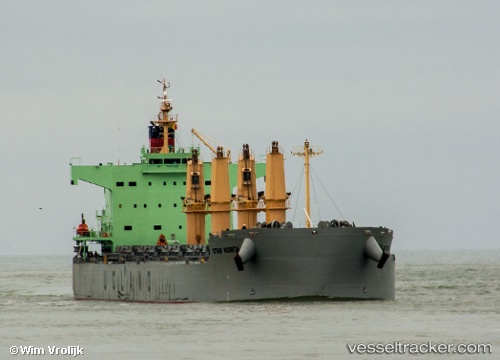
 Star Norita
Current Status
Where is the vessel?
Star Norita is currently in 29 nm SW of Dulang Marine Terminal, based on AIS data received less than 1h ago.
Latest AIS update:
Current position: 5.44945° N, 103.83329° E (29 nm SW of Dulang Marine Terminal)
Average speed (last 7 days): Loading…
Average speed (last 30 days): Loading…
Vessel profile: Star Norita is a Bulk Carrier with dimensions 190m x 32m.
This page combines live AIS, route history, probable destination signals, nearby traffic, and port activity for practical vessel monitoring.
The current position of vessel Star Norita is 5.44945 lat / 103.83329 lng. Updated: 2026-05-14 04:52:32 UTCNearest reference points:
- 29 nm SW of Dulang Marine Terminal
- Near KEMAMAN
- Near Cukai
Currently sailing under the flag of Norway ![]()
Star Norita built in 2012 year
Deadweight:
58097 tDetails:
Live Vessel Star Norita Analytics (details, animations, etc.)
Recent AIS points (UTC):
2026-05-14 01:08:32 UTC · 4.98667, 104.09333 · SOG 8 kn · COG -1°2026-05-14 01:08:32 UTC · 4.98667, 104.09333 · SOG 8 kn · COG -1°
2026-05-14 03:47:53 UTC · 5.32286, 103.91755 · SOG 8.4 kn · COG 325°
2026-05-14 04:52:32 UTC · 5.44945, 103.83329 · SOG 8.2 kn · COG 324°