 vesseltracker.com
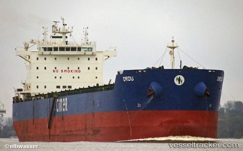
 Ordu
Ordu
Current Status
Where is the vessel?
Ordu is currently in 13 nm S of Chin-Huang-Tao, based on AIS data received about 1h ago.
Latest AIS update:
Current position: 39.71450° N, 119.68500° E (13 nm S of Chin-Huang-Tao)
Average speed (last 7 days): Loading…
Average speed (last 30 days): Loading…
Vessel profile: Ordu is a Bulk Carrier with dimensions 229m x 229m.
This page combines live AIS, route history, probable destination signals, nearby traffic, and port activity for practical vessel monitoring.
The current position of vessel Ordu is 39.7145 lat / 119.685 lng. Updated: 2026-05-16 10:28:21 UTCNearest reference points:
- Near Chin-Huang-Tao
- Near SHANHAIGUAN
- 33 nm SE of SHANHAIGUAN
Currently sailing under the flag of Malta ![]()
Ordu built in 2012 year
Deadweight:
81950 tDetails:
Live Vessel Ordu Analytics (details, animations, etc.)
Recent AIS points (UTC):
2026-05-16 07:46:22 UTC · 39.71740, 119.68900 · SOG 0 kn · COG 199°2026-05-16 07:49:17 UTC · 39.71740, 119.68900 · SOG 0 kn · COG 198°
2026-05-16 10:19:21 UTC · 39.71480, 119.68500 · SOG 0.1 kn · COG 65°
2026-05-16 10:28:21 UTC · 39.71450, 119.68500 · SOG 0 kn · COG 59°