 vesseltracker.com
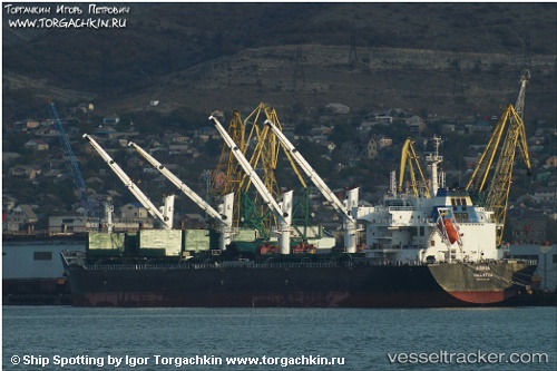
 Agria
Agria
Current Status
Where is the vessel?
Agria is currently in Near NEMRUT, based on AIS data received less than 1h ago.
Latest AIS update:
Current position: 38.76817° N, 26.91026° E (Near NEMRUT)
Average speed (last 7 days): Loading…
Average speed (last 30 days): Loading…
Vessel profile: Agria is a Bulk Carrier with dimensions 190m x 32m.
This page combines live AIS, route history, probable destination signals, nearby traffic, and port activity for practical vessel monitoring.
The current position of vessel Agria is 38.76817 lat / 26.91026 lng. Updated: 2026-04-17 23:54:45 UTCNearest reference points:
- Near NEMRUT
- Near Nemrut Bay
- Near Aliaga
Currently sailing under the flag of Malta ![]()
Agria built in 2011 year
Deadweight:
56805 tDetails:
Live Vessel Agria Analytics (details, animations, etc.)
Recent AIS points (UTC):
2026-04-17 17:39:46 UTC · 38.76818, 26.91027 · SOG 0 kn · COG 157°2026-04-17 19:51:50 UTC · 38.76824, 26.91035 · SOG 0 kn · COG 157°
2026-04-17 21:30:43 UTC · 38.76819, 26.91032 · SOG 0 kn · COG 157°
2026-04-17 23:54:45 UTC · 38.76817, 26.91026 · SOG 0 kn · COG 157°