 vesseltracker.com
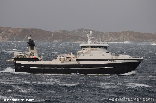
 Prestfjord
Current Status
Where is the vessel?
Prestfjord is currently in 63 nm S of Bjornoya, based on AIS data received about 1h ago.
Latest AIS update:
Current position: 73.45403° N, 19.35991° E (63 nm S of Bjornoya)
Average speed (last 7 days): Loading…
Average speed (last 30 days): Loading…
Vessel profile: Prestfjord is a Fishing Vessel with dimensions 65m x 65m.
This page combines live AIS, route history, probable destination signals, nearby traffic, and port activity for practical vessel monitoring.
The current position of vessel Prestfjord is 73.45403 lat / 19.35991 lng. Updated: 2026-05-15 17:31:23 UTCNearest reference points:
- 40 nm SW of Snohvit
Currently sailing under the flag of Norway ![]()
Prestfjord built in 2012 year
Deadweight:
1250 tDetails:
Live Vessel Prestfjord Analytics (details, animations, etc.)
Recent AIS points (UTC):
2026-05-15 13:27:11 UTC · 73.76667, 17.63500 · SOG 9 kn · COG -1°2026-05-15 14:38:05 UTC · 73.67570, 18.08772 · SOG 7.5 kn · COG 134°
2026-05-15 16:03:11 UTC · 73.55500, 18.64333 · SOG 8 kn · COG -1°
2026-05-15 17:31:23 UTC · 73.45403, 19.35991 · SOG 10.4 kn · COG 115°