 vesseltracker.com
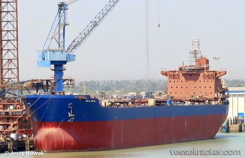
Sea Opal
Current StatusWhere is the vessel?
Sea Opal is currently in 233 nm N of Port Mathurin, based on AIS data received less than 1h ago.
Latest AIS update:
Current position: 15.98516° S, 64.65911° E (233 nm N of Port Mathurin)
Average speed (last 7 days): Loading…
Average speed (last 30 days): Loading…
Vessel profile: Sea Opal is a Bulk Carrier with dimensions 32m x 229m.
This page combines live AIS, route history, probable destination signals, nearby traffic, and port activity for practical vessel monitoring.
The current position of vessel Sea Opal is -15.98516 lat / 64.65911 lng. Updated: 2026-04-27 05:44:54 UTCNearest reference points:
- 154 nm NE of Port Mathurin
- 241 nm N of Port Mathurin
- 353 nm NE of Port Mathurin
Details:
Live Vessel Sea Opal Analytics (details, animations, etc.)
Recent AIS points (UTC):
2026-04-27 02:24:13 UTC · -16.32565, 64.18371 · SOG 10 kn · COG 56°2026-04-27 03:47:55 UTC · -16.18498, 64.37768 · SOG 10 kn · COG 58°
2026-04-27 04:39:01 UTC · -16.09710, 64.50114 · SOG 10.3 kn · COG 59°
2026-04-27 05:44:54 UTC · -15.98516, 64.65911 · SOG 10.5 kn · COG 60°