 vesseltracker.com
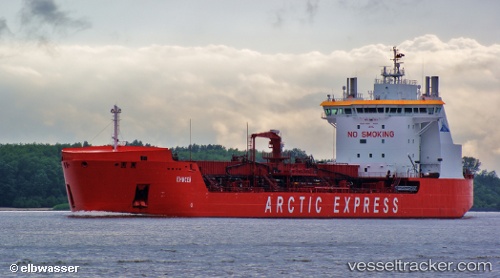
 ENISEY
Current Status
Where is the vessel?
ENISEY is currently in Near Dudinka, based on AIS data received less than 1h ago.
Latest AIS update:
Current position: 69.42833° N, 86.13333° E (Near Dudinka)
Average speed (last 7 days): Loading…
Average speed (last 30 days): Loading…
Vessel profile: ENISEY is a Oil Products Tanker with dimensions 169m x 27m.
This page combines live AIS, route history, probable destination signals, nearby traffic, and port activity for practical vessel monitoring.
The current position of vessel ENISEY is 69.42833 lat / 86.13333 lng. Updated: 2026-05-14 07:55:40 UTCCurrently sailing under the flag of Russia ![]()
ENISEY built in 2011 year
Deadweight:
18902 tDetails:
Live Vessel ENISEY Analytics (details, animations, etc.)
Recent AIS points (UTC):
2026-05-14 01:13:36 UTC · 69.42833, 86.13333 · SOG 0 kn · COG -1°2026-05-14 05:55:36 UTC · 69.42833, 86.13333 · SOG 0 kn · COG -1°
2026-05-14 06:04:38 UTC · 69.42833, 86.13333 · SOG 0 kn · COG -1°
2026-05-14 07:55:40 UTC · 69.42833, 86.13333 · SOG 0 kn · COG -1°