 vesseltracker.com
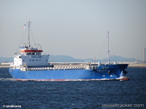
 HANDONG 23
Current Status
Where is the vessel?
HANDONG 23 is currently in Near Busan, based on AIS data received less than 1h ago.
Latest AIS update:
Current position: 35.12147° N, 129.04993° E (Near Busan)
Average speed (last 7 days): Loading…
Average speed (last 30 days): Loading…
Vessel profile: HANDONG 23 is a General Cargo Ship with dimensions 77m x 12m.
This page combines live AIS, route history, probable destination signals, nearby traffic, and port activity for practical vessel monitoring.
The current position of vessel HANDONG 23 is 35.12147 lat / 129.04993 lng. Updated: 2026-05-14 07:36:40 UTCNearest reference points:
- Near Busan
- Near Gamcheon/Busan
- Near Gijang-gun/Busan
Currently sailing under the flag of Korea (Republic of) ![]()
HANDONG 23 built in 2010 year
Deadweight:
1705 tDetails:
Live Vessel HANDONG 23 Analytics (details, animations, etc.)
Recent AIS points (UTC):
2026-05-14 03:41:00 UTC · 35.12143, 129.04994 · SOG 0 kn · COG 83°2026-05-14 04:27:49 UTC · 35.12143, 129.04994 · SOG 0 kn · COG 82°
2026-05-14 06:29:49 UTC · 35.12145, 129.04993 · SOG 0 kn · COG 81°
2026-05-14 07:36:40 UTC · 35.12147, 129.04993 · SOG 0 kn · COG 81°