 vesseltracker.com
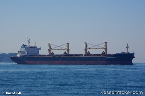
 AGERI
AGERI
Current Status
Where is the vessel?
AGERI is currently in Near GRESIK, based on AIS data received less than 1h ago.
Latest AIS update:
Current position: 7.08824° S, 112.65282° E (Near GRESIK)
Average speed (last 7 days): Loading…
Average speed (last 30 days): Loading…
Vessel profile: AGERI is a Bulk Carrier with dimensions m x m.
This page combines live AIS, route history, probable destination signals, nearby traffic, and port activity for practical vessel monitoring.
The current position of vessel AGERI is -7.08824 lat / 112.65282 lng. Updated: 2026-05-14 01:05:40 UTCNearest reference points:
- Near GRESIK
- Near Bangkalan
- Near Gresik, Java
Currently sailing under the flag of Portugal ![]()
Details:
Live Vessel AGERI Analytics (details, animations, etc.)
Recent AIS points (UTC):
2026-05-13 22:02:39 UTC · -7.08823, 112.65283 · SOG 0 kn · COG 357°2026-05-13 22:14:41 UTC · -7.08823, 112.65282 · SOG 0 kn · COG 357°
2026-05-13 23:44:37 UTC · -7.08823, 112.65281 · SOG 0 kn · COG 357°
2026-05-14 01:05:40 UTC · -7.08824, 112.65282 · SOG 0 kn · COG 357°