 vesseltracker.com
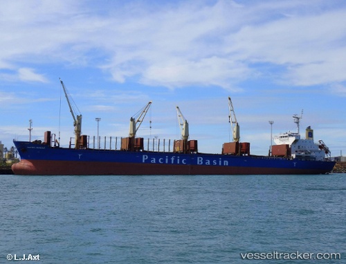
 ROYAL GALAXY
Current Status
Where is the vessel?
ROYAL GALAXY is currently in 54 nm S of Zhapo, based on AIS data received about 4h ago.
Latest AIS update:
Current position: 20.68469° N, 112.07322° E (54 nm S of Zhapo)
Average speed (last 7 days): Loading…
Average speed (last 30 days): Loading…
Vessel profile: ROYAL GALAXY is a Bulk Carrier with dimensions m x m.
This page combines live AIS, route history, probable destination signals, nearby traffic, and port activity for practical vessel monitoring.
The current position of vessel ROYAL GALAXY is 20.68469 lat / 112.07322 lng. Updated: 2026-05-14 23:28:44 UTCNearest reference points:
- 46 nm S of Zhapo
- 28 nm SE of Shapa
- 57 nm NE of Honghai
Currently sailing under the flag of Panama ![]()
Details:
Live Vessel ROYAL GALAXY Analytics (details, animations, etc.)
Recent AIS points (UTC):
2026-05-14 20:13:43 UTC · 20.91333, 112.63500 · SOG 10 kn · COG -1°2026-05-14 22:08:44 UTC · 20.78071, 112.31061 · SOG 10 kn · COG 232°
2026-05-14 22:28:41 UTC · 20.75167, 112.25500 · SOG 10 kn · COG -1°
2026-05-14 23:28:44 UTC · 20.68469, 112.07322 · SOG 10 kn · COG 243°