 vesseltracker.com
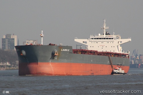
 LAURA D
Current Status
Where is the vessel?
LAURA D is currently in 60 nm E of FRASER ISLAND, based on AIS data received less than 1h ago.
Latest AIS update:
Current position: 25.20048° S, 154.11388° E (60 nm E of FRASER ISLAND)
Average speed (last 7 days): Loading…
Average speed (last 30 days): Loading…
Vessel profile: LAURA D is a Cargo with dimensions m x m.
This page combines live AIS, route history, probable destination signals, nearby traffic, and port activity for practical vessel monitoring.
The current position of vessel LAURA D is -25.20048 lat / 154.11388 lng. Updated: 2026-05-14 22:19:44 UTCNearest reference points:
- Near HERVEY BAY
- Near Tin Can Bay
- Near NOOSAVILLE
Currently sailing under the flag of Portugal ![]()
Details:
Live Vessel LAURA D Analytics (details, animations, etc.)
Recent AIS points (UTC):
2026-05-14 19:43:02 UTC · -24.71783, 154.09549 · SOG 11.4 kn · COG 174°2026-05-14 20:24:34 UTC · -24.84205, 154.10323 · SOG 10.9 kn · COG 174°
2026-05-14 21:44:11 UTC · -25.08859, 154.11330 · SOG 11.1 kn · COG 175°
2026-05-14 22:19:44 UTC · -25.20048, 154.11388 · SOG 11.7 kn · COG 180°