 vesseltracker.com
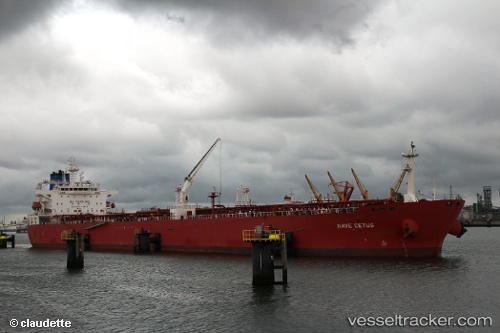
Nave Cetus
Current StatusWhere is the vessel?
Nave Cetus is currently in Near Ciudad Madero, based on AIS data received less than 1h ago.
Latest AIS update:
Current position: 22.25334° N, 97.81208° W (Near Ciudad Madero)
Average speed (last 7 days): Loading…
Average speed (last 30 days): Loading…
Vessel profile: Nave Cetus is a Crude Oil Tanker with dimensions 32m x 228m.
This page combines live AIS, route history, probable destination signals, nearby traffic, and port activity for practical vessel monitoring.
The current position of vessel Nave Cetus is 22.25334 lat / -97.81208 lng. Updated: 2026-05-15 00:20:44 UTCNearest reference points:
- 25 nm E of Tuxpan
Details:
Live Vessel Nave Cetus Analytics (details, animations, etc.)
Recent AIS points (UTC):
2026-05-14 20:08:43 UTC · 22.25350, -97.81225 · SOG 0.1 kn · COG 241°2026-05-14 22:05:46 UTC · 22.25336, -97.81218 · SOG 0 kn · COG 241°
2026-05-14 22:08:45 UTC · 22.25332, -97.81226 · SOG 0 kn · COG 241°
2026-05-15 00:20:44 UTC · 22.25334, -97.81208 · SOG 0 kn · COG 241°