 vesseltracker.com
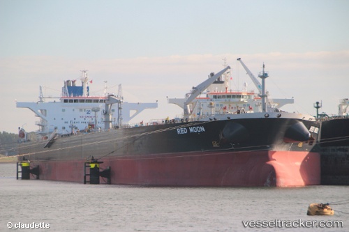
Red Moon
Current StatusWhere is the vessel?
Red Moon is currently in Near LUTCHER, based on AIS data received less than 1h ago.
Latest AIS update:
Current position: 30.04875° N, 90.64176° W (Near LUTCHER)
Average speed (last 7 days): Loading…
Average speed (last 30 days): Loading…
Vessel profile: Red Moon is a Crude Oil Tanker with dimensions 48m x 274m.
This page combines live AIS, route history, probable destination signals, nearby traffic, and port activity for practical vessel monitoring.
The current position of vessel Red Moon is 30.04875 lat / -90.64176 lng. Updated: 2026-04-27 22:26:46 UTCNearest reference points:
- Near Port Of South Louisiana
- Near Good Hope
- Near Boutte
Details:
Live Vessel Red Moon Analytics (details, animations, etc.)
Recent AIS points (UTC):
2026-04-27 18:06:59 UTC · 29.99952, -90.83431 · SOG 0.1 kn · COG 350°2026-04-27 18:06:59 UTC · 29.99952, -90.83431 · SOG 0.1 kn · COG 350°
2026-04-27 22:02:36 UTC · 30.01502, -90.71880 · SOG 12.8 kn · COG 57°
2026-04-27 22:26:46 UTC · 30.04875, -90.64176 · SOG 8.9 kn · COG 135°