 vesseltracker.com
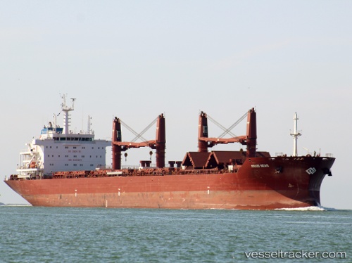
 ANGEL
ANGEL
Current Status
Where is the vessel?
ANGEL is currently in 346 nm N of Sapiranga, based on AIS data received less than 1h ago.
Latest AIS update:
Current position: 23.86289° S, 25.31591° W (346 nm N of Sapiranga)
Average speed (last 7 days): Loading…
Average speed (last 30 days): Loading…
Vessel profile: ANGEL is a Cargo with dimensions m x m.
This page combines live AIS, route history, probable destination signals, nearby traffic, and port activity for practical vessel monitoring.
The current position of vessel ANGEL is -23.86289 lat / -25.31591 lng. Updated: 2026-05-16 13:36:21 UTCNearest reference points:
- Open sea (no nearby ports in database)
- Open sea, approx. 404 nm off the nearest listed port
- Open sea, approx. 406 nm off the nearest listed port
Currently sailing under the flag of Liberia ![]()
Details:
Live Vessel ANGEL Analytics (details, animations, etc.)
Recent AIS points (UTC):
2026-05-16 09:53:36 UTC · -23.50005, -24.64971 · SOG 11.5 kn · COG 235°2026-05-16 11:05:02 UTC · -23.61833, -24.85833 · SOG 11 kn · COG -1°
2026-05-16 11:20:01 UTC · -23.64167, -24.90333 · SOG 11 kn · COG -1°
2026-05-16 13:36:21 UTC · -23.86289, -25.31591 · SOG 11.6 kn · COG 238°