 vesseltracker.com
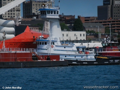
 Denali
Current Status
Where is the vessel?
Denali is currently in 43 nm SE of Beals, based on AIS data received less than 1h ago.
Latest AIS update:
Current position: 43.89333° N, 67.12500° W (43 nm SE of Beals)
Average speed (last 7 days): Loading…
Average speed (last 30 days): Loading…
Vessel profile: Denali is a Tug with dimensions 152m x 24m.
This page combines live AIS, route history, probable destination signals, nearby traffic, and port activity for practical vessel monitoring.
The current position of vessel Denali is 43.89333 lat / -67.12500 lng. Updated: 2026-05-14 19:19:14 UTCNearest reference points:
- 16 nm W of Tiverton
- Near Tiverton
- Near Wedgeport
Currently sailing under the flag of USA ![]()
Denali built in 2010 year
Deadweight:
278 tDetails:
Live Vessel Denali Analytics (details, animations, etc.)
Recent AIS points (UTC):
2026-05-14 15:40:13 UTC · 43.69833, -67.30667 · SOG 4 kn · COG -1°2026-05-14 16:20:48 UTC · 43.73121, -67.27774 · SOG 3.8 kn · COG 38°
2026-05-14 17:22:13 UTC · 43.79333, -67.23833 · SOG 4 kn · COG -1°
2026-05-14 19:19:14 UTC · 43.89333, -67.12500 · SOG 4 kn · COG -1°