 vesseltracker.com
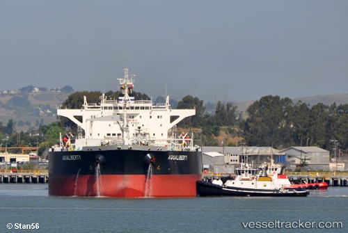
Aqualiberty
Current StatusWhere is the vessel?
Aqualiberty is currently in Near Melones, based on AIS data received about 1h ago.
Latest AIS update:
Current position: 8.79518° N, 79.59065° W (Near Melones)
Average speed (last 7 days): Loading…
Average speed (last 30 days): Loading…
Vessel profile: Aqualiberty is a Crude Oil Tanker with dimensions 44m x 249m.
This page combines live AIS, route history, probable destination signals, nearby traffic, and port activity for practical vessel monitoring.
The current position of vessel Aqualiberty is 8.79518 lat / -79.59065 lng. Updated: 2026-05-14 19:43:46 UTCNearest reference points:
- Near Melones
- Near Panama
- Near El Chorrillo
Details:
Live Vessel Aqualiberty Analytics (details, animations, etc.)
Recent AIS points (UTC):
2026-05-14 16:46:46 UTC · 8.79636, -79.59318 · SOG 0.1 kn · COG 69°2026-05-14 18:04:46 UTC · 8.79523, -79.59154 · SOG 0.1 kn · COG 14°
2026-05-14 19:34:46 UTC · 8.79534, -79.59056 · SOG 0 kn · COG 351°
2026-05-14 19:43:46 UTC · 8.79518, -79.59065 · SOG 0.1 kn · COG 352°