 vesseltracker.com
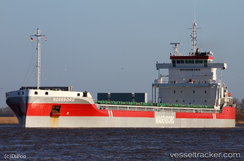
 Roerborg
Current Status
Where is the vessel?
Roerborg is currently in 57 nm N of Corvo Island Apt, based on AIS data received about 1h ago.
Latest AIS update:
Current position: 40.65173° N, 31.08304° W (57 nm N of Corvo Island Apt)
Average speed (last 7 days): Loading…
Average speed (last 30 days): Loading…
Vessel profile: Roerborg is a General Cargo Ship with dimensions 170m x 20m.
This page combines live AIS, route history, probable destination signals, nearby traffic, and port activity for practical vessel monitoring.
The current position of vessel Roerborg is 40.65173 lat / -31.08304 lng. Updated: 2026-05-14 16:29:39 UTCCurrently sailing under the flag of Netherlands ![]()
Roerborg built in 2014 year
Deadweight:
23000 tDetails:
Live Vessel Roerborg Analytics (details, animations, etc.)
Recent AIS points (UTC):
2026-05-14 12:22:23 UTC · 40.73738, -32.05452 · SOG 10.9 kn · COG 93°2026-05-14 14:00:20 UTC · 40.70463, -31.66728 · SOG 11.1 kn · COG 92°
2026-05-14 16:18:59 UTC · 40.65631, -31.12401 · SOG 10.7 kn · COG 96°
2026-05-14 16:29:39 UTC · 40.65173, -31.08304 · SOG 10.7 kn · COG 95°