 vesseltracker.com
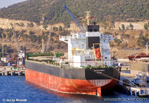
 ALEXANDRIA
Current Status
Where is the vessel?
ALEXANDRIA is currently in 120 nm SE of Maputo, based on AIS data received about 1h ago.
Latest AIS update:
Current position: 27.06667° S, 34.43667° E (120 nm SE of Maputo)
Average speed (last 7 days): Loading…
Average speed (last 30 days): Loading…
Vessel profile: ALEXANDRIA is a Cargo with dimensions m x m.
This page combines live AIS, route history, probable destination signals, nearby traffic, and port activity for practical vessel monitoring.
The current position of vessel ALEXANDRIA is -27.06667 lat / 34.43667 lng. Updated: 2026-05-14 19:49:23 UTCNearest reference points:
- 162 nm SE of Xai-Xai
- 42 nm E of Richards Bay
Currently sailing under the flag of Marshall Islands ![]()
Details:
Live Vessel ALEXANDRIA Analytics (details, animations, etc.)
Recent AIS points (UTC):
2026-05-14 16:07:46 UTC · -27.52446, 34.00946 · SOG 9.1 kn · COG 44°2026-05-14 18:22:24 UTC · -27.24833, 34.26833 · SOG 9 kn · COG -1°
2026-05-14 19:40:25 UTC · -27.08615, 34.41934 · SOG 9.8 kn · COG 43°
2026-05-14 19:49:23 UTC · -27.06667, 34.43667 · SOG 9 kn · COG -1°