 vesseltracker.com
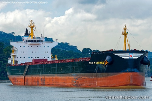
John M Carras
Current StatusWhere is the vessel?
John M Carras is currently in 278 nm S of Abakaliki, based on AIS data received less than 1h ago.
Latest AIS update:
Current position: 1.87726° N, 84.76913° E (278 nm S of Abakaliki)
Average speed (last 7 days): Loading…
Average speed (last 30 days): Loading…
Vessel profile: John M Carras is a Bulk Carrier with dimensions 32m x 229m.
This page combines live AIS, route history, probable destination signals, nearby traffic, and port activity for practical vessel monitoring.
The current position of vessel John M Carras is 1.87726 lat / 84.76913 lng. Updated: 2026-05-14 05:30:26 UTCNearest reference points:
- Open sea, approx. 401 nm off the nearest listed port
- Open sea, approx. 402 nm off the nearest listed port
- Open sea, approx. 403 nm off the nearest listed port
Details:
Live Vessel John M Carras Analytics (details, animations, etc.)
Recent AIS points (UTC):
2026-05-14 01:57:26 UTC · 1.61777, 84.12011 · SOG 11.7 kn · COG 61°2026-05-14 03:43:59 UTC · 1.74944, 84.44666 · SOG 11.8 kn · COG 63°
2026-05-14 03:43:59 UTC · 1.74944, 84.44666 · SOG 11.8 kn · COG 63°
2026-05-14 05:30:26 UTC · 1.87726, 84.76913 · SOG 11.8 kn · COG 67°