 vesseltracker.com
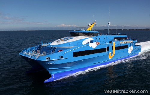
Liberty
Current StatusWhere is the vessel?
Liberty is currently in Near Pointe A Pitre, based on AIS data received less than 1h ago.
Latest AIS update:
Current position: 16.24012° N, 61.54066° W (Near Pointe A Pitre)
Average speed (last 7 days): Loading…
Average speed (last 30 days): Loading…
Vessel profile: Liberty is a Passenger Ship with dimensions 11m x 47m.
This page combines live AIS, route history, probable destination signals, nearby traffic, and port activity for practical vessel monitoring.
The current position of vessel Liberty is 16.24012 lat / -61.54066 lng. Updated: 2026-05-13 13:43:48 UTCNearest reference points:
- Near Pointe A Pitre
- Near Le Gosier
- Near ANTIGUA
Details:
Live Vessel Liberty Analytics (details, animations, etc.)
Recent AIS points (UTC):
2026-05-13 10:40:59 UTC · 16.24011, -61.54066 · SOG 0 kn · COG -1°2026-05-13 11:45:49 UTC · 16.24011, -61.54066 · SOG 0 kn · COG -1°
2026-05-13 13:34:38 UTC · 16.24012, -61.54066 · SOG 0 kn · COG -1°
2026-05-13 13:43:48 UTC · 16.24012, -61.54066 · SOG 0 kn · COG -1°