 vesseltracker.com
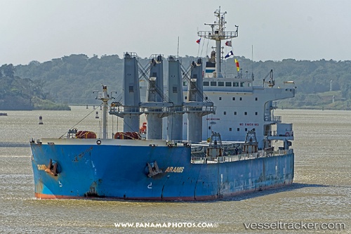
 Aramis
Current Status
Where is the vessel?
Aramis is currently in 33 nm SW of Belanak Terminal, based on AIS data received about 3h ago.
Latest AIS update:
Current position: 3.82125° N, 105.80358° E (33 nm SW of Belanak Terminal)
Average speed (last 7 days): Loading…
Average speed (last 30 days): Loading…
Vessel profile: Aramis is a Bulk Carrier with dimensions 190m x 190m.
This page combines live AIS, route history, probable destination signals, nearby traffic, and port activity for practical vessel monitoring.
The current position of vessel Aramis is 3.82125 lat / 105.80358 lng. Updated: 2026-05-15 18:42:30 UTCNearest reference points:
- 30 nm SW of Belanak Terminal
- 39 nm SE of Belida Terminal
- 26 nm E of Belida Terminal
Currently sailing under the flag of Marshall Is ![]()
Aramis built in 2012 year
Deadweight:
55830 tDetails:
Live Vessel Aramis Analytics (details, animations, etc.)
Recent AIS points (UTC):
2026-05-15 17:05:16 UTC · 3.47983, 105.57791 · SOG 12 kn · COG 33°2026-05-15 18:42:30 UTC · 3.82125, 105.80358 · SOG 11.7 kn · COG 34°
2026-05-15 18:42:30 UTC · 3.82125, 105.80358 · SOG 11.7 kn · COG 34°
2026-05-15 18:42:30 UTC · 3.82125, 105.80358 · SOG 11.7 kn · COG 34°