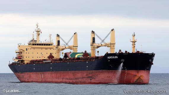
 Hercules
Current Status
Where is the vessel?
Hercules is currently in Near Chittagong, based on AIS data received about 15h ago.
Latest AIS update:
Current position: 22.22923° N, 91.74103° E (Near Chittagong)
Average speed (last 7 days): Loading…
Average speed (last 30 days): Loading…
Vessel profile: Hercules is a Bulk Carrier with dimensions 189m x 32m.
This page combines live AIS, route history, probable destination signals, nearby traffic, and port activity for practical vessel monitoring.
The current position of vessel Hercules is 22.22923 lat / 91.74103 lng. Updated: 2026-05-23 11:42:00 UTCNearest reference points:
- Near Chittagong
- 12 nm NW of Chattogram
- 23 nm NW of Cox's Bazar
Currently sailing under the flag of Marshall Is ![]()
Hercules built in 2012 year
Deadweight:
56546 tDetails:
Live Vessel Hercules Analytics (details, animations, etc.)
Recent AIS points (UTC):
2026-05-23 08:21:02 UTC · 22.22862, 91.74082 · SOG 0.3 kn · COG 166°2026-05-23 09:38:59 UTC · 22.22920, 91.74073 · SOG 0.3 kn · COG 168°
2026-05-23 10:36:01 UTC · 22.22922, 91.74068 · SOG 0.4 kn · COG 171°
2026-05-23 11:42:00 UTC · 22.22923, 91.74103 · SOG 0.3 kn · COG 175°