 vesseltracker.com
 Lolland
Current Status
Where is the vessel?
Lolland is currently in Near SPODSBJERG, based on AIS data received less than 1h ago.
Latest AIS update:
Current position: 54.93270° N, 10.84586° E (Near SPODSBJERG)
Average speed (last 7 days): Loading…
Average speed (last 30 days): Loading…
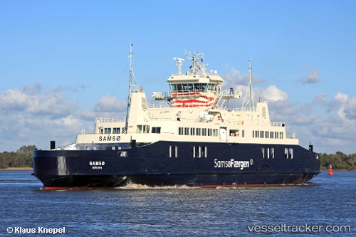
Vessel profile: Lolland is a Passenger Ro Ro Cargo Ship with dimensions 98m x 18m.
This page combines live AIS, route history, probable destination signals, nearby traffic, and port activity for practical vessel monitoring.
The current position of vessel Lolland is 54.93270 lat / 10.84586 lng. Updated: 2026-05-15 06:19:05 UTCNearest reference points:
- Near SPODSBJERG
- Near RUDKOBING
- Near Lundeborg
Currently sailing under the flag of Denmark ![]()
Lolland built in 2012 year
Deadweight:
949 tDetails:
Live Vessel Lolland Analytics (details, animations, etc.)
Recent AIS points (UTC):
2026-05-15 01:15:47 UTC · 54.87608, 11.02867 · SOG 0 kn · COG 250°2026-05-15 03:59:07 UTC · 54.93493, 10.83390 · SOG 0 kn · COG 106°
2026-05-15 04:41:16 UTC · 54.89043, 10.92818 · SOG 13.2 kn · COG 109°
2026-05-15 06:19:05 UTC · 54.93270, 10.84586 · SOG 10.6 kn · COG 124°