 vesseltracker.com
 RIA
RIA
Current Status
Where is the vessel?
RIA is currently in Near Safi, based on AIS data received about 3h ago.
Latest AIS update:
Current position: 32.28988° N, 9.29157° W (Near Safi)
Average speed (last 7 days): Loading…
Average speed (last 30 days): Loading…
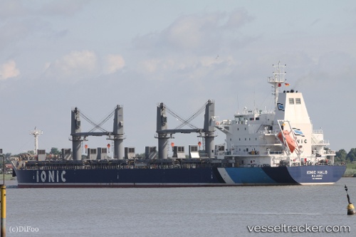
Vessel profile: RIA is a Bulk Carrier with dimensions 180m x 30m.
This page combines live AIS, route history, probable destination signals, nearby traffic, and port activity for practical vessel monitoring.
The current position of vessel RIA is 32.28988 lat / -9.29157 lng. Updated: 2026-05-14 12:12:49 UTCNearest reference points:
- 32 nm NW of Safi
- 52 nm NW of Safi
- Near Jorf Lasfar
Currently sailing under the flag of Liberia ![]()
RIA built in 2012 year
Deadweight:
34039 tDetails:
Live Vessel RIA Analytics (details, animations, etc.)
Recent AIS points (UTC):
2026-05-14 09:57:48 UTC · 32.29019, -9.29083 · SOG 0.1 kn · COG 328°2026-05-14 09:57:48 UTC · 32.29019, -9.29083 · SOG 0.1 kn · COG 328°
2026-05-14 12:12:49 UTC · 32.28988, -9.29157 · SOG 0.1 kn · COG 351°
2026-05-14 12:12:49 UTC · 32.28988, -9.29157 · SOG 0.1 kn · COG 351°