 vesseltracker.com
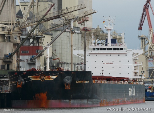
Caravos Harmony
Current StatusWhere is the vessel?
Caravos Harmony is currently in 400 nm S of Sao Filipe, based on AIS data received about 1h ago.
Latest AIS update:
Current position: 8.24183° N, 24.61379° W (400 nm S of Sao Filipe)
Average speed (last 7 days): Loading…
Average speed (last 30 days): Loading…
Vessel profile: Caravos Harmony is a Bulk Carrier with dimensions 32m x 229m.
This page combines live AIS, route history, probable destination signals, nearby traffic, and port activity for practical vessel monitoring.
The current position of vessel Caravos Harmony is 8.24183 lat / -24.61379 lng. Updated: 2026-04-24 13:43:02 UTCNearest reference points:
- Open sea (no nearby ports in database)
- Open sea, approx. 401 nm off the nearest listed port
- Open sea, approx. 402 nm off the nearest listed port
Details:
Live Vessel Caravos Harmony Analytics (details, animations, etc.)
Recent AIS points (UTC):
2026-04-24 10:00:51 UTC · 7.60299, -24.89459 · SOG 11.4 kn · COG 23°2026-04-24 11:55:50 UTC · 7.93635, -24.74365 · SOG 11 kn · COG 25°
2026-04-24 13:30:59 UTC · 8.20724, -24.62774 · SOG 11 kn · COG 22°
2026-04-24 13:43:02 UTC · 8.24183, -24.61379 · SOG 11.1 kn · COG 22°