 vesseltracker.com
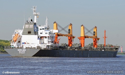
 NORDLOIRE
Current Status
Where is the vessel?
NORDLOIRE is currently in 108 nm NW of Parelhas, based on AIS data received about 1h ago.
Latest AIS update:
Current position: 8.25667° N, 37.52667° W (108 nm NW of Parelhas)
Average speed (last 7 days): Loading…
Average speed (last 30 days): Loading…
Vessel profile: NORDLOIRE is a Bulk Carrier with dimensions 189m x 28m.
This page combines live AIS, route history, probable destination signals, nearby traffic, and port activity for practical vessel monitoring.
The current position of vessel NORDLOIRE is 8.25667 lat / -37.52667 lng. Updated: 2026-05-14 19:39:08 UTCCurrently sailing under the flag of Portugal (MAR) ![]()
NORDLOIRE built in 2013 year
Deadweight:
37212 tDetails:
Live Vessel NORDLOIRE Analytics (details, animations, etc.)
Recent AIS points (UTC):
2026-05-14 16:24:04 UTC · 8.70500, -37.00167 · SOG 12 kn · COG -1°2026-05-14 17:48:54 UTC · 8.51106, -37.23107 · SOG 12.5 kn · COG 228°
2026-05-14 19:24:05 UTC · 8.29167, -37.48667 · SOG 12 kn · COG -1°
2026-05-14 19:39:08 UTC · 8.25667, -37.52667 · SOG 12 kn · COG -1°