 vesseltracker.com
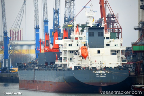
 NORDRHONE
Current Status
Where is the vessel?
NORDRHONE is currently in Open sea (no nearby ports in database), based on AIS data received less than 1h ago.
Latest AIS update:
Current position: 33.15480° S, 105.44520° E (Open sea (no nearby ports in database))
Average speed (last 7 days): Loading…
Average speed (last 30 days): Loading…
Vessel profile: NORDRHONE is a Bulk Carrier with dimensions 190m x 190m.
This page combines live AIS, route history, probable destination signals, nearby traffic, and port activity for practical vessel monitoring.
The current position of vessel NORDRHONE is -33.15480 lat / 105.44520 lng. Updated: 2026-05-14 04:48:45 UTCNearest reference points:
- Open sea (no nearby ports in database)
- Open sea, approx. 400 nm off the nearest listed port
Currently sailing under the flag of Portugal (MAR) ![]()
NORDRHONE built in 2015 year
Deadweight:
38036 tDetails:
Live Vessel NORDRHONE Analytics (details, animations, etc.)
Recent AIS points (UTC):
2026-05-14 01:02:34 UTC · -33.09333, 106.12667 · SOG 8 kn · COG -1°2026-05-14 01:36:53 UTC · -33.10438, 106.02938 · SOG 9.1 kn · COG 264°
2026-05-14 03:42:02 UTC · -33.13653, 105.65292 · SOG 9 kn · COG 259°
2026-05-14 04:48:45 UTC · -33.15480, 105.44520 · SOG 9.8 kn · COG 263°